Lake Suigetsu - The 'Miracle Lake' Recording 70,000 Years of Earth's History
A small lake in Fukui Prefecture became the world standard for dating. Earth's memory recorded in 45 meters of sediment
Why a small Japanese lake is called the 'Greenwich Observatory of geology'. Its miraculous conditions explained
Lake Suigetsu: The 'Miracle Lake' Recording 70,000 Years of Earth's History
Japan's Hidden Treasure Recognized by the World
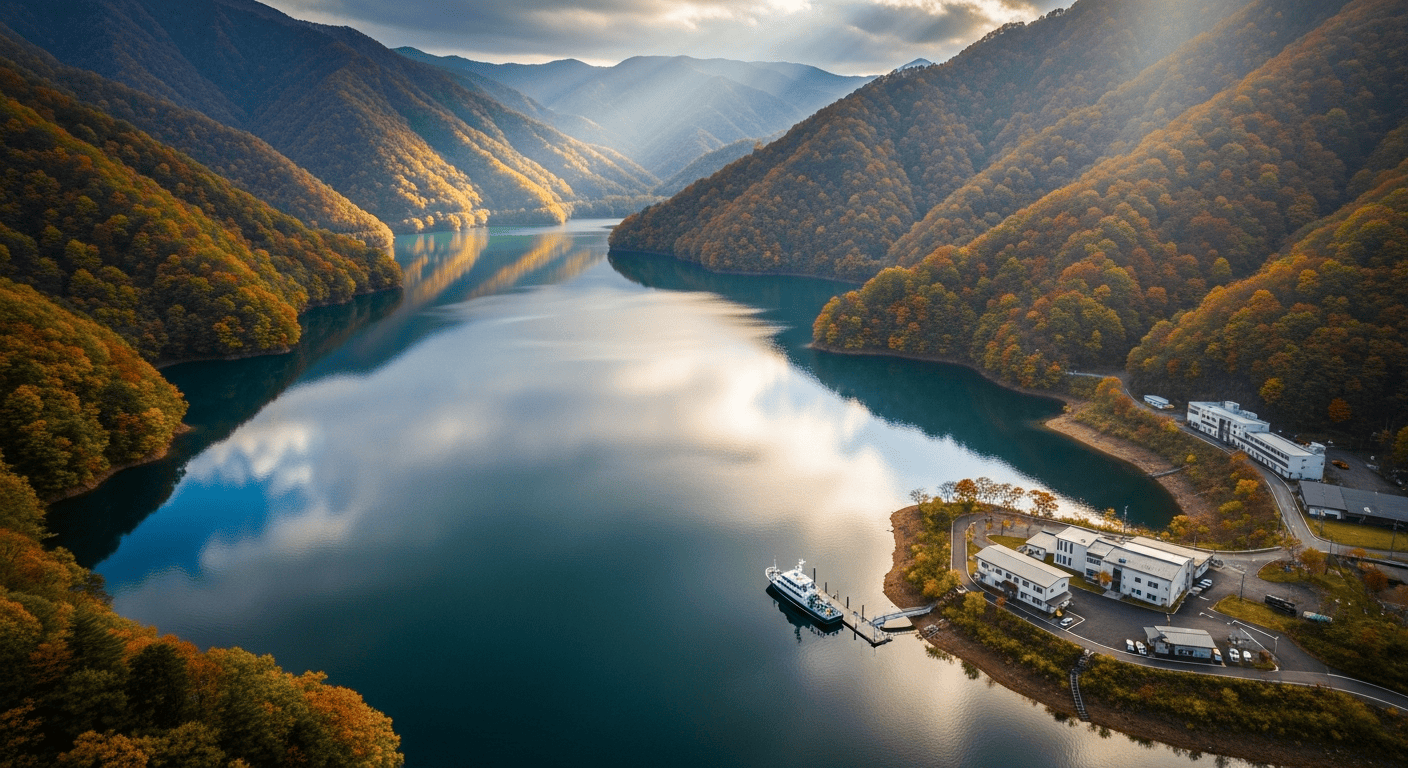
Nestled in the mountains of Fukui Prefecture, Lake Suigetsu appears to be just another quiet lake in rural Japan. However, beneath its calm surface lies an extraordinary record of Earth's history spanning 70,000 years, preserved in layers of sediment like a natural barcode. These layers, called varves, were adopted as part of the international radiocarbon calibration standard "IntCal" in 2012, earning Lake Suigetsu the title of "Greenwich Observatory of Geology."
What Are Varves?
Varves are annual layers of sediment that accumulate at the bottom of lakes. In Lake Suigetsu, during spring and summer, dead plankton settles to form dark layers, while in autumn and winter, clay minerals settle to form light layers. Each light-dark pair represents one year.
Lake Suigetsu's varves extend to a depth of 45 meters, comprising over 70,000 layers - an unbroken record spanning more than 70,000 years.
Why Is Lake Suigetsu a 'Miracle Lake'?
While many lakes exist worldwide, few preserve such long-term varve records. Lake Suigetsu owes its remarkable preservation to several miraculous conditions:
1. No Direct River Inflow
Rivers carry large amounts of sediment during floods, disturbing varve layers. Lake Suigetsu lacks major rivers flowing directly into it, allowing varves to accumulate undisturbed.
2. No Bottom-Dwelling Organisms
At 38 meters deep, Lake Suigetsu's bottom is anoxic (oxygen-free), preventing bottom-dwelling creatures from living there. Without bioturbation (biological disturbance), sediment layers remain intact.
3. Perfect Balance of Subsidence and Sedimentation
Due to a nearby fault, Lake Suigetsu's bottom subsides at approximately 0.7 millimeters per year - almost exactly matching the sedimentation rate. This prevents the lake from filling up while allowing continuous varve accumulation.
Earth's Memory Encoded in Varves
Lake Suigetsu's varves contain multiple types of information:
- Pollen - Reconstructs past vegetation and climate
- Plankton - Records water temperature changes
- Volcanic ash - Pinpoints exact dates of eruptions
- Yellow sand (Asian dust) - Reflects continental drying
- Carbon-14 - Used for radiocarbon dating calibration
Becoming the World Standard
In 2012, Professor Takeshi Nakagawa of Ritsumeikan University and his research team contributed radiocarbon data from Lake Suigetsu varves to the international calibration curve "IntCal13." This dramatically improved dating precision for the past 50,000 years, making Lake Suigetsu the world's "measuring stick" for archaeology and geology.
Professor Nakagawa stated: "It's the world standard for measuring history. Lake Suigetsu is the Greenwich Observatory of geology."
Ongoing Research
Research at Lake Suigetsu continues today. Analysis of pollen, volcanic ash, and paleomagnetic data from the varves is revealing ice age climate changes, ancient volcanic eruptions, and even Earth's magnetic field reversals - all dated to individual years.
The Fukui Prefectural Varve Museum displays actual varve samples from Lake Suigetsu. This "time capsule" containing 70,000 years of Earth's history quietly awaits visitors.
[!] Various theories exist. Information may contain errors.