Nazca Lines Were Maps of Underground Water
Recent research reveals connection between lines and underground water. Ancient technology for finding water in desert
Recent research reveals connection between lines and underground water. Ancient technology for finding water in desert
The Nazca Lines: Ancient Maps to Desert Water Sources
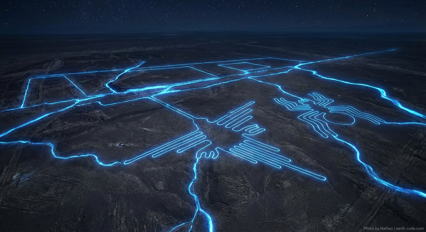
For decades, the massive geoglyphs etched into Peru's Nazca Desert have puzzled archaeologists and captivated the public imagination. These enormous lines and figures, some stretching over 1,200 feet in length, have spawned theories ranging from astronomical calendars to alien landing strips. However, groundbreaking research is revealing a far more practical and ingenious purpose: the Nazca Lines may have served as sophisticated maps guiding ancient peoples to precious underground water sources in one of the world's most arid landscapes.
Revolutionary Research Findings
Recent interdisciplinary studies combining archaeological investigation with hydrological analysis have uncovered compelling evidence linking the Nazca Lines to underground water systems. Researchers from multiple institutions have used ground-penetrating radar, satellite imagery, and geological surveys to map both the surface geoglyphs and subsurface water channels across the Nazca plateau.
The findings reveal that many of the straight lines, known as "geoglyphs," align remarkably well with underground aquifers and ancient riverbeds. Dr. Rosa Lasaponara from Italy's National Research Council led studies showing that approximately 80% of the trapezoid-shaped geoglyphs correspond to areas where water sources were likely accessible through wells or natural springs. This correlation is far too significant to be coincidental, suggesting deliberate planning and sophisticated understanding of local hydrology.
Ancient Water Management Technology
The Nazca civilization, which flourished between 100 and 700 CE, developed remarkable engineering solutions to survive in their harsh desert environment. Archaeological evidence shows they constructed an extensive network of underground aqueducts called "puquios," many of which remain functional today. These spiral-shaped wells and underground channels represent some of the most advanced pre-Columbian hydraulic engineering in the Americas.
The connection between the surface lines and underground water systems reveals the Nazca people's extraordinary technical knowledge. They appear to have created a visible mapping system that could guide community members to water sources across vast desert expanses. The lines may have functioned as a form of ancient GPS, with different geometric shapes and directions indicating specific types of water sources, seasonal availability, or maintenance requirements for the underground systems.
Practical Purpose Over Mystery
This water-mapping theory provides a compelling explanation for several puzzling aspects of the Nazca Lines. The enormous scale of the geoglyphs, visible only from elevated positions, makes perfect sense if they were meant to be reference points for navigation across the featureless desert terrain. The precision and maintenance required to keep these lines visible over centuries also aligns with their critical importance to community survival.
Additionally, the variety of shapes and patterns found among the geoglyphs may represent a sophisticated coding system. Different geometric forms could have indicated various aspects of water management: straight lines pointing to seasonal streams, spirals marking permanent aquifer locations, or trapezoids identifying areas suitable for well construction.
Legacy of Innovation
The revelation that the Nazca Lines functioned as water maps demonstrates the remarkable ingenuity of ancient civilizations in adapting to challenging environments. Rather than mysterious religious symbols or astronomical markers, these geoglyphs represent practical technology – a desert survival system that enabled a complex society to thrive in one of Earth's most challenging landscapes.
This research not only solves one of archaeology's enduring mysteries but also offers valuable insights for modern water management in arid regions, proving that ancient wisdom often holds solutions for contemporary challenges.